Maps of various cities and countries already existed in antiquity. Certain kinds of ancient maps have been preserved, including Mseopotamian maps drawn on clay in the third millennium B.C. and Roman mosaic maps. Our knowledge of ancient maps is still limited: details about them remain imprecise, since they are based on written sources rather that on the maps themselves. For example, the Alexandrian geographer Ptolemy (127-151 A.D.) wrote that his works made use of earlier works by Marinus of Tyre. Ptolemy also refers to the construction of celestial globes. It is certain that celestial globes - maps of the heavens - were already made in the Hellenistic era.
During the Middle Ages, there emerged a new approach to mapmaking. Religious and philosophical discussions led mapmakers to express contemporary visions of the cosmos in their work. The world came to be represented in different shapes - some geometric, others taken from nature. This was also the period that saw the development of the first portolan charts - early modern navigation charts that indicated the location of harbors and anchorages.
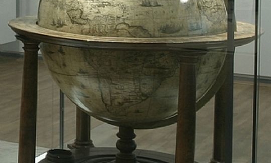
The scientific renaissance that took place during the 15th and 16th centuries, combined with the geographical explorations of the Age of Discovery, immediately manifested themselves in cartography and globe making. New maps were made as guides for voyages and for educational purposes. The continents came to be depicted on these maps with increasing accuracy, and new conventions for the use of color emerged. Globes, which were sometimes made of precious metals, were also used to guide seafarers. Of particular importance were the celestial globes called Armillary Spheres, which delineated the movement of certain heavenly bodies.